Les Ollières-sur-Eyrieux - Le Siècle - Les Bruas - Église Saint-Pierre
Jízda na kole
Navigace na stránkách
Navigace na stránkách
Pořiďte si tuto prohlídku do mobilního telefonu
Les Ollières-sur-Eyrieux - Le Siècle - Les Bruas - Église Saint-Pierre
Jízda na kole
52.02
km
Naskenujte QR kód a spusťte navigaci v aplikaci bergfex.

Pěší turistika a stopování


Les Ollières-sur-Eyrieux - Le Siècle - Les Bruas - Église Saint-Pierre
Jízda na kole
Vzdálenost
52.02
km
Doba trvání
04:33
h
Ascent
304
hm
Hladina moře
146 -
693
m
Stažení skladby
Les Ollières-sur-Eyrieux - Le Siècle - Les Bruas - Église Saint-Pierre
Jízda na kole
52.02
km
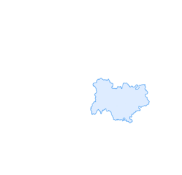
Trasa
Les Ollières-sur-Eyrieux
(177 m)
Vesnice
0.0 km
Dunière-sur-Eyrieux
(162 m)
Vesnice
4.0 km
La Plaine
(163 m)
Vypořádání
7.4 km
Roumezoux
(467 m)
Vypořádání
14.0 km
Église Saint-Pierre
(591 m)
Místo konání bohoslužeb
22.3 km
Chalencon
(682 m)
Vesnice
30.4 km
La Blache
(258 m)
Vypořádání
47.3 km
Trasa
Les Ollières-sur-Eyrieux - Le Siècle - Les Bruas - Église Saint-Pierre
Jízda na kole
52.02
km
Les Ollières-sur-Eyrieux
(177 m)
Vesnice
0.0 km
Le Siècle
(201 m)
Restaurace
0.5 km
Les Bruas
(208 m)
Vypořádání
1.6 km
La Pimpie
(200 m)
Vypořádání
2.3 km
La Gare
(169 m)
Koridor/terén
2.5 km
Les Terras
(194 m)
Vypořádání
2.7 km
Pelet
(194 m)
Vypořádání
3.8 km
Dunière-sur-Eyrieux
(162 m)
Vesnice
4.0 km
Sélas
(156 m)
Vypořádání
4.8 km
Avezac
(153 m)
Sousedství
5.8 km
Chez Jean-Pierre
(149 m)
Restaurace
6.0 km
Saint-Fortunat-sur-Eyrieux
(151 m)
Vesnice
6.5 km
Glandoux
(170 m)
Vypořádání
6.7 km
Le Pré
(155 m)
Vypořádání
6.7 km
La Plaine
(163 m)
Vypořádání
7.4 km
La Planche
(165 m)
Vypořádání
7.5 km
Le Monteil
(202 m)
Vypořádání
7.6 km
Dunière-sur-Eyrieux
(162 m)
Vesnice
7.6 km
Le Pont
(154 m)
Vypořádání
7.7 km
Praneuf
(326 m)
Vypořádání
11.7 km
Les Riailles
(427 m)
Vypořádání
12.0 km
Roumezoux
(467 m)
Vypořádání
14.0 km
Les Quatre Ponts
(448 m)
Vypořádání
18.2 km
Le Vernet
(543 m)
Vypořádání
20.3 km
Tacanet
(567 m)
Sousedství
21.1 km
Sajourne
(568 m)
Sousedství
21.5 km
Vernoux-en-Vivarais
(588 m)
Vesnice
22.1 km
Bistrot St Anne- Maison Cornu
(589 m)
Restaurace
22.2 km
Église Saint-Pierre
(591 m)
Místo konání bohoslužeb
22.3 km
Clozel
(572 m)
Vypořádání
22.8 km
Reviscolle
(508 m)
Vypořádání
23.7 km
Le Beley
(483 m)
Vypořádání
24.5 km
Le Vignal
(585 m)
Sousedství
26.4 km
Silhac
(589 m)
Vesnice
26.7 km
Chalencon
(682 m)
Vesnice
30.4 km
Pont de Chervil
(312 m)
Vypořádání
37.5 km
Le Vigneron
(288 m)
Koridor/terén
40.4 km
Geys
(277 m)
Vypořádání
42.7 km
La Roche
(255 m)
Vypořádání
43.7 km
Saint-Sauveur-de-Montagut
(218 m)
Vesnice
46.5 km
La Rive
(209 m)
Koridor/terén
47.0 km
La Blache
(258 m)
Vypořádání
47.3 km
Le Moulinon
(204 m)
Sousedství
48.1 km
Issantouans
(205 m)
Vypořádání
48.4 km
L'assiette du jardin
(198 m)
Restaurace
49.7 km
Les Ollières-sur-Eyrieux
(177 m)
Vesnice
51.8 km
Zatím žádné recenze
Oblíbené prohlídky v okolí
Lamastre - Temple - Lamastre Est
Jízda na kole 20.2 kmPrivas - Église Saint-Julien - Église Sainte-Madeleine - La Ville
heavyJízda na kole 95.8 kmBoucieu-le-Roi - Temple - Église de l'Exaltation-de-la-Sainte-Croix - Église Saint-Martin
Jízda na kole 171.0 kmLe P'tit Bistro d'Alboussière - Col des Fans - Église de l'Exaltation-de-la-Sainte-Croix - Alboussière
Jízda na kole 40.2 km- 4.0
Saint-Laurent-du-Pape - Léouzée
středníTuristika 6.90 km Grottes de la Jaubernie - Col de la croix - Serre de Gruas - Col de la Croix de la Vialette
středníTuristika 18.0 kmLe Provençal - La Gare - Église Saint-Jacques - Retourtour
heavyJízda na kole 21.7 kmLe Colombier - Domaze Est - La Treille - L'épicea
heavyMountainbike 88.9 kmÉglise Saint-François-Régis - Les Ollières-sur-Eyrieux - L'assiette du jardin - La Breure
heavyMountainbike 98.1 kmTemple - Laigua - Pié Lafont - Saint-Sauveur-de-Montagut
středníTuristika 14.4 km

Pěší turistika a stopování

Více než 550.000 návrhů výletů, podrobné mapy a intuitivní plánovač tras dělají z aplikace nezbytnou výbavu pro všechny milovníky přírody.

Nenechte si ujít nabídky a inspiraci pro vaši příští dovolenou
Přihlaste se k odběru newsletteru
Chyba
Došlo k chybě. Zkuste to prosím znovu.Děkujeme za vaši registraci
Vaše e-mailová adresa byl přidán do poštovního seznamu.
Zájezdy po celé Evropě
Rakousko Švýcarsko Německo Itálie Slovenia Francie Nizozemsko Belgie Polsko Lichtenštejnsko Česko Slovensko Španělsko Chorvatsko Bosna a Hercegovina Lucembursko Andorra Portugal Iceland United Kingdom Ireland Greece Albania North Macedonia Malta Norway Montenegro Moldova Kosovo Hungary San Marino Romania Estonia Latvia Belarus Cyprus Lithuania Serbia Bulgaria Monaco Denmark Sweden Finland