


M3 Mountain Bike Tour from Monsols to St. Igny


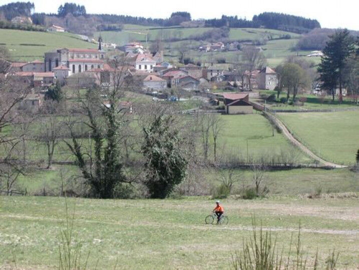
This very sporty and technical trail gives you the opportunity to do the grand tour of the St-Rigaud massif. Beware, there are several tricky passages, two passes and a summit ahead. However, you will...
This very sporty and technical trail gives you the opportunity to do the grand tour of the St-Rigaud massif. Beware, there are several tricky passages, two passes and a summit ahead. However, you will be able to enjoy the rolling hills and beautiful views, especially at the top where there is a spring to quench your thirst.
APIDAE tourism data updated on 03/02/2021 by "Destination Beaujolais".
Spotted an error? Write to the owner with the following information:
File name: Circuit VTT M13 de Monsols à St Igny | Record identifier: 162079 | URL (link) for this Outdooractive page.
Oblíbené prohlídky v okolí
-
De l’Aze à l’Ergues - Beaujolais Vert - Claveisolles
světloTuristika 13.0 km -
CycloRoute71 - Etape 11 de La Clayette à Cluny
středníJízda na kole 56.8 km -
La balade des rhododendrons
světloJízda na koni 7.18 km -
Circuit des digitales
středníTuristika 13.9 km -
Sentier botanique
světloJízda na koni 5.12 km -
M5 Mountain Bike Tour from Trades to St. Christopher
světloMountainbike 16.5 km -
M2 Mountain Bike Tour from St Bonnet to St Christophe
heavyMountainbike 35.6 km -
The tour of the Crochet mountain and Tourvéon mount
světloTuristika 13.1 km -
B9 Mountain Bike Tour Marchampt
heavyMountainbike 19.8 km -
B7 Mountain Bike Tour from Régnié-Durette to Lantignié
světloMountainbike 19.1 km
Pěší turistika a stopování


Nenechte si ujít nabídky a inspiraci pro vaši příští dovolenou
Vaše e-mailová adresa byl přidán do poštovního seznamu.