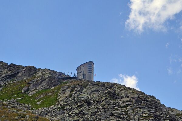
© Trail Verbier St-Bernard by UTMB®


- Stručný popis
-
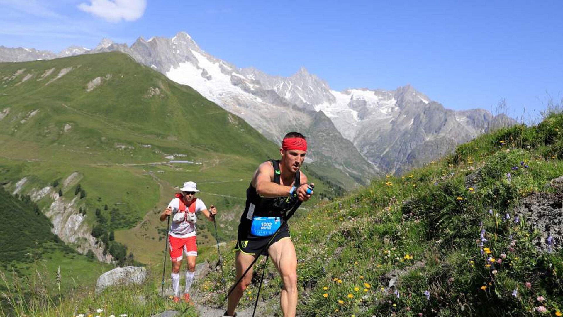
The great trail of the Swiss Alps, the X-Alpine will make you discover the most beautiful viewpoints of the region by cumulating a positive height difference of 8'400m. This new route is resolutely alpine and is a real challenge for experienced trailers.
- Obtížnost
-
těžké
- Hodnocení
-
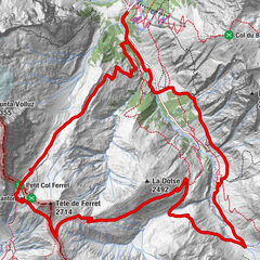
- Trasa
-
Verbier (1.490 m)0,1 kmPatier1,5 kmSaint Christophe2,9 kmCries7,8 kmGrotte9,9 kmSommet de Contô10,1 kmEtiez10,8 kmFond de Contô11,2 kmLes Moulins11,5 kmMaison Murith11,5 kmPontet de la Meunière11,5 kmMeunière des Moulins11,6 kmMaison Blanche11,6 kmChamprateu11,6 kmSommet du Biollay11,7 kmChampanet11,7 kmPessote11,7 kmSavu11,8 kmLa Colô11,9 kmFaray12,3 kmLes 3 Dranses12,5 kmVers la Tour12,5 kmPont de Bagnes12,5 kmGrand Place12,5 kmSouste12,5 kmRière Ville12,5 kmSembrancher12,5 kmMaison Luder12,6 kmHôtel National12,6 kmDerrière les Granges12,6 kmSommet de Ville12,7 kmGrange à Body12,7 kmCleusuit Devant12,7 kmRière les Puces12,7 kmCreuse12,8 kmTête de la Chaux13,0 kmChamp de l'Ouraz13,9 kmChampcortay d'en Bas14,2 kmLes Biolles14,4 kmFond du Creux14,4 kmVers la Croix14,5 kmLa Garde14,5 kmCreuland14,5 kmRière les Maisons14,6 kmLes Grevets14,7 kmLes Fieudzes14,7 kmValettes14,7 kmCaret14,8 kmLa Dent (1.640 m)17,9 kmProcari18,1 kmCatogne (1.810 m)19,1 kmMont Regard (1.850 m)19,2 kmLes Waillaz19,5 kmPlan de la Chaux19,9 kmDerrière la Tournelle20,5 kmLe Catogne (2.598 m)22,5 kmChampex-Lac26,6 kmArpette29,4 kmCabane d'Orny (2.831 m)35,0 kmPrayon46,0 kmL'Amône47,7 kmEdelweiss48,9 kmAuberge de la Fouly49,0 kmAuberge des Glaciers49,1 kmLa Fouly49,1 kmFerret52,6 kmRistorante Hotel Italia62,6 kmPlan Jupiter62,8 kmGreat St Bernard Hospice63,4 kmHôtel de l'Hospice63,5 kmBourg-Saint-Pierre (1.632 m)77,4 kmEglise Saint-Pierre77,5 kmAuberge Au Petit Vélan77,6 kmBivouac Napoléon78,8 kmCreux du Mâ81,5 kmCabane de Mille (2.473 m)90,0 kmLourtier101,8 kmLa Ruine101,8 kmLes Morgnes102,2 kmBaya102,4 kmPierra Besse103,0 kmLa Chaux (2.273 m)107,6 kmLa Chaux 2107,7 kmLe Dahu108,0 kmClambin112,5 kmMédran113,9 kmVerbier (1.490 m)114,4 km
- Nejlepší sezóna
-
ledúnobředubkvěčenčecsrpzářříjlispro
- Nejvyšší bod
- 2.820 m
- Cílová destinace
-
Verbier
- Výškový profil
-
 © outdooractive.com


- Autor
-
Prohlídka Trail Verbier St-Bernard používá outdooractive.com na adrese ..
GPS Downloads


Obecné informace
Zastávka s občerstvením
Léčivé klima
Kulturní/Historické stránky
Slibný
Další výlety v regionech