© Erlebnisregion Schladming-Dachstein - Christoph Lukas
- Stručný popis
-
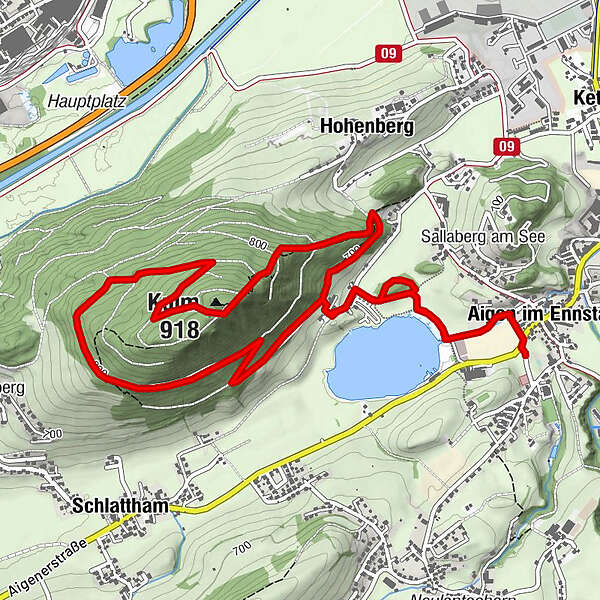
Forest roads and single trails lead to the highest point of the Kulm. The view is surprising and deserves a break at the bench. The downhill offers steep forest terrain to let off steam and have real fun. Then it goes sharply right over the "Höhenweg" with lake view back.
- Obtížnost
-
snadno
- Hodnocení
-
- Trasa
-
Aigen im Ennstal0,1 kmKulm (918 m)4,4 kmHohenberg5,4 kmAigen im Ennstal6,7 km
- Nejlepší sezóna
-
ledúnobředubkvěčenčecsrpzářříjlispro
- Nejvyšší bod
- 900 m
- Cílová destinace
-
Parkingplace tennis court
- Výškový profil
-


-

-
AutorProhlídka Kulm-Summit-Trail používá outdooractive.com na adrese ..
GPS Downloads


Obecné informace
Zastávka s občerstvením
Fauna
Slibný
Další výlety v regionech