


The Savennières vineyards
Úroveň obtížnosti: T1
Savennières is also part of the vast Val de Loire, a UNESCO World Heritage site since 2000.
Tourist attractions :
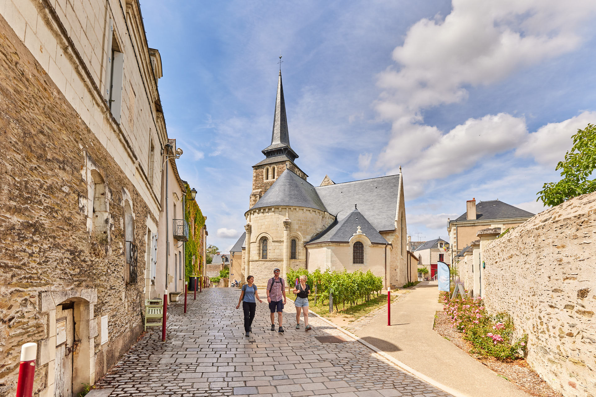
- The town of Savennières is built around the church of Saint-Pierre et Saint-Romain, considered...
Tourist attractions :
- The town of Savennières is built around the church of Saint-Pierre et Saint-Romain, considered to be the oldest standing Christian building in Anjou.
- The Bécherelle stone, located downstream from the confluence of the Loire and Maine rivers and facing the northern tip of the Ile de Béhuard, is a huge, ancient natural monolith that has become a rock-climbing site.
- The picturesque little village of Épiré lies halfway between Savennières and Bouchemaine. Its former church is now privately owned and houses the winery of the Château d'Épiré wine estate.
- This is a very pleasant walk to take in spring and late summer, as you can see the various stages of vineyard work among the rows of vines.
Facilities available:
- Toilets near the town hall
- Picnic tables in Place du Mail and Parc du Fresnes
Starting point :
- Place du Mail, Savennières
Practical information :
- Bicycle trail
- Trail not passable during flood periods
Route marked in mauve.


Route marked in purple.
Ano
Ano
Angers and its surroundings, rich in their confluence landscapes, are sometimes subject to flood risks throughout the year. Some trails may be temporarily impassable, remain vigilant.
In case of emergency, dial 112.
Consider carpooling.
Parking near the starting point.
T1
Be vigilant, especially when crossing roads or when walking alongside them, but also at all times in nature. It can sometimes present hazardous passages, flooded areas, steep sites, or slippery paths.
Follow the marked paths to avoid getting lost and to limit erosion of soils and natural habitats. Pay attention to the markings and if in doubt, do not hesitate to retrace your steps.
Do not pick protected species and remain discreet to avoid disturbing wildlife.
Some trails are used by cyclists, be vigilant.
This route and the associated GPX track may under no circumstances be shared without mentioning Destination Angers.
Oblíbené prohlídky v okolí
- 4,0
The Anjou loop of La Loire à Vélo - with bac de la Chevalerie
světloJízda na kole 39,1 km La Roche de Murs
světloTuristika 5,50 kmLake, pond and tributary
světloTuristika 18,5 kmTo the confluence of the Loire and the Maine
světloTuristika 18,0 kmBucolic walk around Saint-Léger-de-Linières
světloTuristika 8,11 kmMayenne loop
světloJízda na kole 25,5 kmWalk around Saint-Martin-du-Fouilloux
světloTuristika 10,7 kmA relaxing walk around Béhuard
světloTuristika 9,26 kmThe slate route
heavyTuristika 24,2 kmThe Loire and the horticultural fields
heavyTuristika 19,5 km

Pěší turistika a stopování


Nenechte si ujít nabídky a inspiraci pro vaši příští dovolenou
Vaše e-mailová adresa byl přidán do poštovního seznamu.