- Stručný popis
-
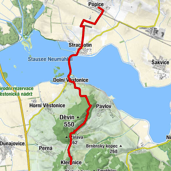
Behind the route, the St. Jacob's Way rises slightly, turns right to the right, passes a smaller airport and descends to Strachotín with a beautiful view of the Novomlýnské reservoirs and Pálava. The village established for pilgrims at the church of St. Oldřich and Metoděj's very nice St. Jacob's bench, on the left is a pilgrim's booth with a stamp on the cemetery wall. There is only 500 m left of the church to the dam dividing the Novomlýnské reservoirs.
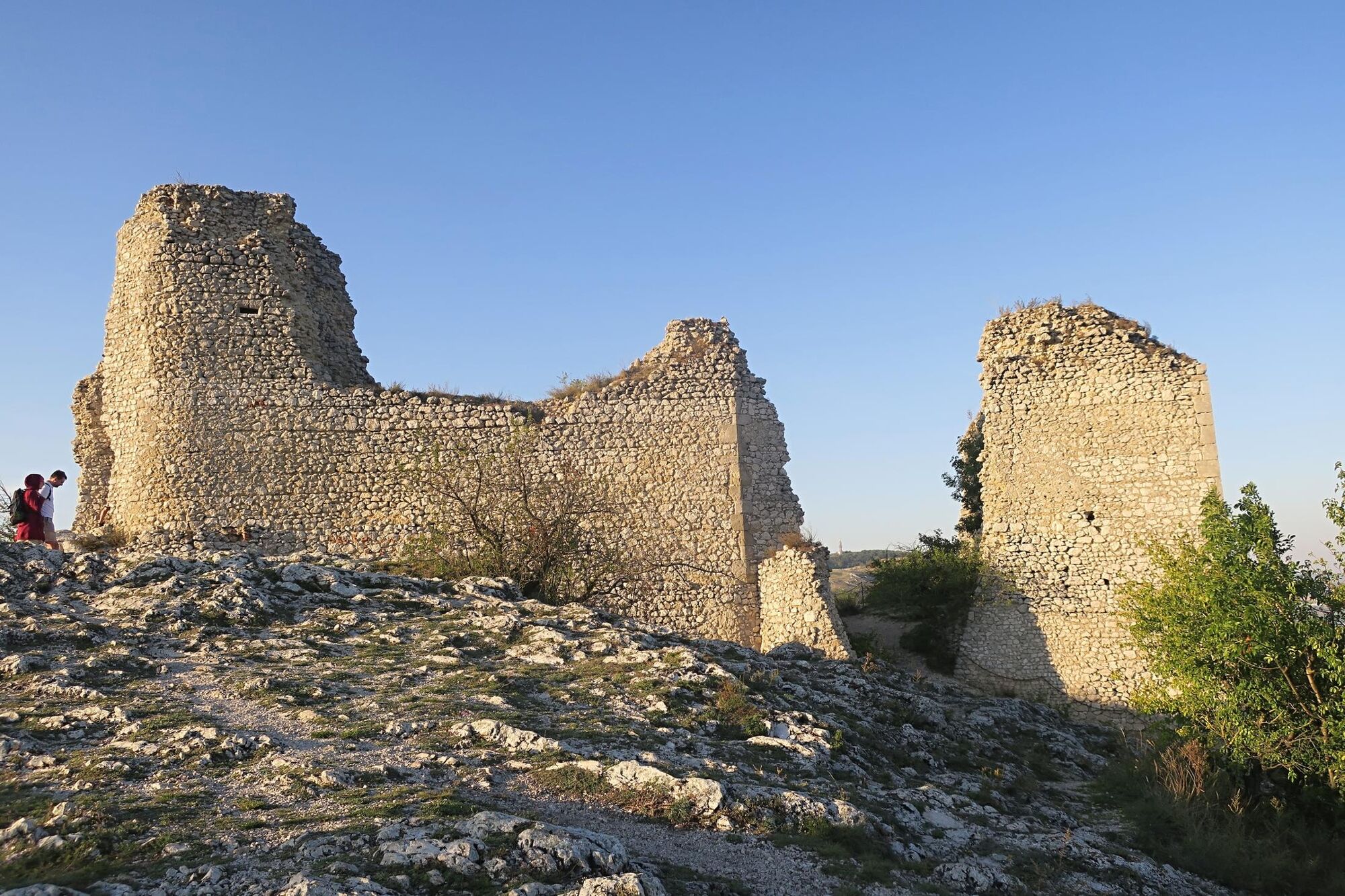
The Strachotín sidewalk connects the Strachotín sidewalk with Dolní Věstonice. Not far from the church of St. Michala, the red-marked path climbs steeply to the right to the cemetery (pilgrim's booth at the gate) and between the vineyards to Děvičky (Dívčí hrady). The St. Jacob's Way from here leads about 5 km along the ridge of the Pálav Hills around the top of Děvín, above Soutěská along the border of the nature reserve to the crossroads of Pavlov, Perná and Klentnice. Only 500 m to Klentnice.
- Trasa
-
PoppitzTracht3,8 kmIsis4,0 kmsv. Oldřich4,2 kmMoravský statek4,2 kmUnter Wisternitz6,3 kmU Srnečka6,3 kmsvatý Michal6,4 kmobčerstvení U zrzavého Rona12,2 kmKlentnitz12,8 km
- Nejlepší sezóna
-
ledúnobředubkvěčenčecsrpzářříjlispro
- Nejvyšší bod
- 409 m
- Cílová destinace
-
Klentnice
- Výškový profil
-
 © outdooractive.com
- Autor
-
Prohlídka Popice - Palava - Klentnice používá outdooractive.com na adrese ..